Lot 259 , YORKSHIRE: Housman, John. A Topographical Description of Cumberland, Westmoreland, Lancashire, and a Part of the West Riding of Yorkshire, first edition, folding map frontispiece with outline hand-colouring, 12 engraved

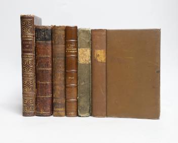
° YORKSHIRE: Housman, John. A Topographical Description of Cumberland, Westmoreland, Lancashire, and a Part of the West Riding of Yorkshire, first edition, folding map frontispiece with outline hand-colouring, 12 engraved plates including 4 folding, contemporary calf, Carlisle, Francis Jollie, 1800, 8vo. Sold with W. Eastmead’s ‘Historia Rievallensis: Containing the History of Kirkby Moorside’, 1824, and ‘The History and Topography of Ashbourn, the Valley of the Dove’, 1839, and William Bray’s ‘Sketch of a Tour into Derbyshire and Yorkshire’, 1783, and two others (6).
£70-100
Condition:
Housman- armorial bookplates of J. Talbot Clifton of Kildalton and Henry Edward Bunbury to front-free endpaper and front pastedown, ink ownership of Henry Bunbury (caricaturist) to title, moderate spotting to preliminaries, map frontispiece and last leaves, (1), xii, 536, ipp.; Eastmead- moderate spotting throught, upper hinge very weak, lacking lettering piece; Ashbourn- label residue to pastedown and front-free endpaper, ex-library stamp verso additional title, firm hinges, light rubbing.
Sold for £95