Lot 264 , HASTINGS - Laing, John (Borough Surveyor) - Map of Hastings and St. Leonards, on linen in red cloth binding with gilt lettering, scale: 12 inches to 1 mile, Hastings, January 1859, 68.5 x 131cms
 - Map of Hastings and St. Leonards, on linen in red cloth binding with gilt lettering, scale: 12 inches to 1 mile, Hastings, January 1859, 68.5 x 131cms")
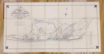
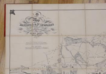
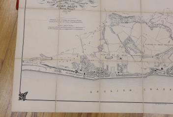
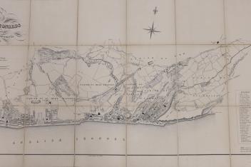
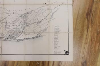
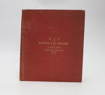
° HASTINGS - Laing, John (Borough Surveyor) - Map of Hastings and St. Leonards, on linen in red cloth binding with gilt lettering, scale: 12 inches to 1 mile, Hastings, January 1859, 68.5 x 131cms
£60-100
Sold for £80